Garmin eTrex 20, Rugged & Lightweight GPS with Maps (Garmin Certified Refurbished)
Garmin eTrex 20, Rugged & Lightweight GPS with Maps (Garmin Certified Refurbished)
Model Number: 010-N0970-10
Out of stock
 View full details
 WhatsApp
 SMS - Text us!
 Email Us!
 Help Desk
Tech Specs
Garmin eTrex 20, Rugged & Lightweight GPS with Maps (Garmin Certified Refurbished)
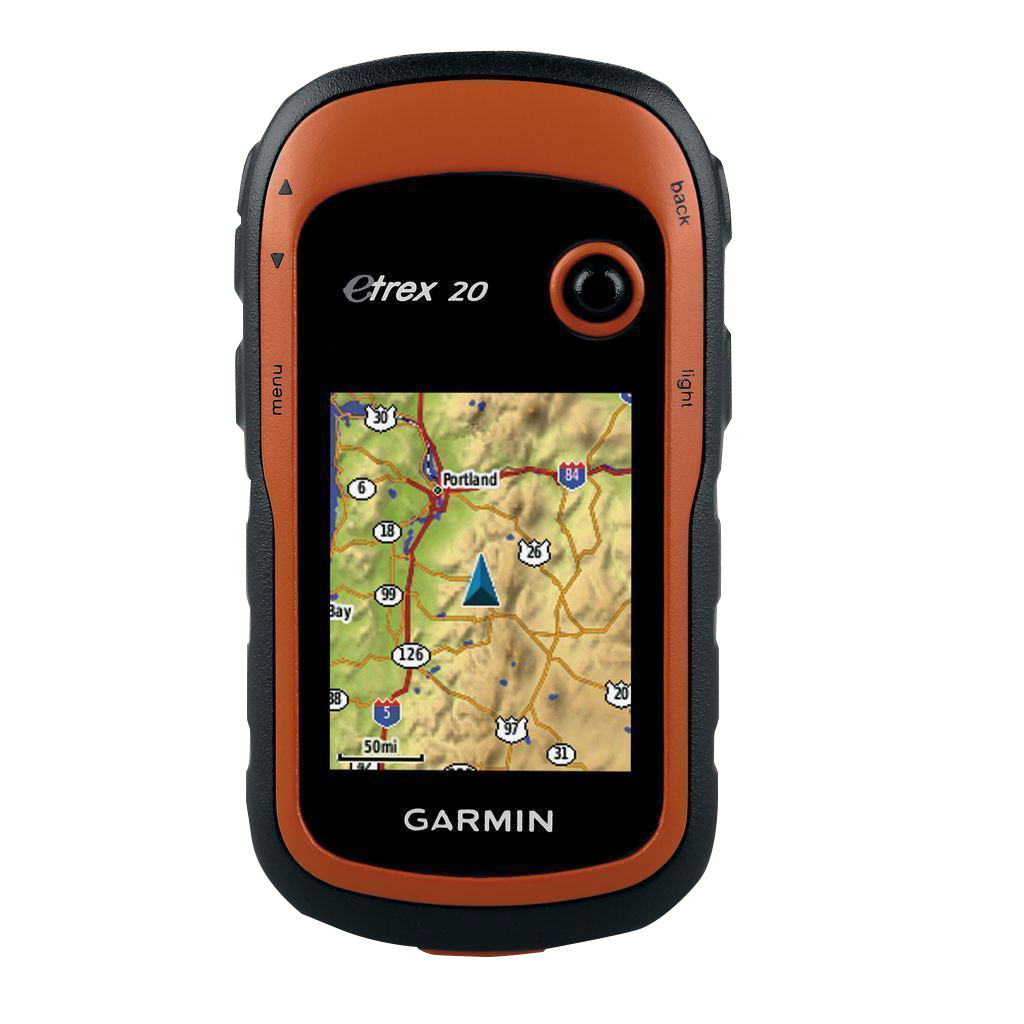
Introducing the Garmin eTrex 20, a remarkable handheld GPS device designed for adventurers and outdoor enthusiasts. This rugged and lightweight GPS unit is packed with features that ensure you are always on the right path.
Key Features:
- Enhanced Display: Equipped with a 2.2", 65K color, sunlight-readable display for clear visibility in any lighting conditions.
- Durable and Waterproof: Built to withstand the toughest environments, the eTrex 20 is durable and waterproof, ensuring it can handle dust, dirt, humidity, and water.
- Versatile Use: Compatible with an array of mounts, perfect for ATVs, bicycles, boats, handheld use, or in your car with auto mount capability.
- Global Satellite Tracking: Tracks both GPS and GLONASS satellites for faster positioning—20% quicker lock-on time and access to 24 additional satellites.
- Expandable Mapping: Features a microSD™ card slot and 1.7 GB of internal memory to load TOPO maps, BlueChart® g2 cards, and City Navigator NT® data for turn-by-turn directions.
- Geocaching Made Easy: Supports paperless geocaching with GPX file downloads, storing essential information for a more efficient and eco-friendly experience.
- Planning Made Simple: Utilize BaseCamp™ software for organizing maps, waypoints, and routes, and create shareable Garmin Adventures with friends and family.
Why Choose the Garmin eTrex 20?
The Garmin eTrex 20 is not just a GPS; it's your reliable companion for any adventure. Whether you’re exploring the mountains, navigating through dense forests, or mapping out a road trip, this device is engineered to keep you on course and informed. Its user-friendly interface, combined with advanced satellite reception and extensive mapping capabilities, makes it an essential tool for every adventurer.
Don’t miss out on the opportunity to enhance your outdoor experiences. Get the Garmin eTrex 20 today and embark on your next adventure with confidence!
In The Box
- eTrex 20
- USB cable
- Quickstart Guide
Manual & Warranty
 Garmin Warranty
Do you have an old GPS unit lying around? The GPS Nation Trade In and Up program is a great way to trade in your old and used GPS for credit towards a new GPS. The choice is entirely yours! We’ve made the process simple and streamlined. Follow these simple steps, and you will be on your way to receiving credit towards your brand new GPS!
1. Get a quote
To get your free quote, provide your GPS type, manufacturer, model, and condition. Within 24 hours, you will receive a quote for the trade-in value of your current product. The GPS trade-in/trade-up form is at the bottom of this page.
2. Ship your product(s) for trade
After accepting our offer, pack your product(s) safely and ship them to us using the pre-paid shipping label provided to you. We will provide a confirmation email when your trade-in arrives at our warehouse. You have 30 days from the date you complete your on-line trade to ship the product to GPS Nation.
3. Make your purchase
Once we receive your product at our warehouse and we validate the stated condition, we will send you a confirmation email. If you elect to receive credit towards a new GPS at gpsnation.com, your store credit will be issued, and you are free to make your purchase.
Reviews
Ask a Question
Tech Specs
Garmin eTrex 20, Rugged & Lightweight GPS with Maps (Garmin Certified Refurbished)
Introducing the Garmin eTrex 20, a remarkable handheld GPS device designed for adventurers and outdoor enthusiasts. This rugged and lightweight GPS unit is packed with features that ensure you are always on the right path.
Key Features:
- Enhanced Display: Equipped with a 2.2", 65K color, sunlight-readable display for clear visibility in any lighting conditions.
- Durable and Waterproof: Built to withstand the toughest environments, the eTrex 20 is durable and waterproof, ensuring it can handle dust, dirt, humidity, and water.
- Versatile Use: Compatible with an array of mounts, perfect for ATVs, bicycles, boats, handheld use, or in your car with auto mount capability.
- Global Satellite Tracking: Tracks both GPS and GLONASS satellites for faster positioning—20% quicker lock-on time and access to 24 additional satellites.
- Expandable Mapping: Features a microSD™ card slot and 1.7 GB of internal memory to load TOPO maps, BlueChart® g2 cards, and City Navigator NT® data for turn-by-turn directions.
- Geocaching Made Easy: Supports paperless geocaching with GPX file downloads, storing essential information for a more efficient and eco-friendly experience.
- Planning Made Simple: Utilize BaseCamp™ software for organizing maps, waypoints, and routes, and create shareable Garmin Adventures with friends and family.
Why Choose the Garmin eTrex 20?
The Garmin eTrex 20 is not just a GPS; it's your reliable companion for any adventure. Whether you’re exploring the mountains, navigating through dense forests, or mapping out a road trip, this device is engineered to keep you on course and informed. Its user-friendly interface, combined with advanced satellite reception and extensive mapping capabilities, makes it an essential tool for every adventurer.
Don’t miss out on the opportunity to enhance your outdoor experiences. Get the Garmin eTrex 20 today and embark on your next adventure with confidence!
In The Box
- eTrex 20
- USB cable
- Quickstart Guide
Manual & Warranty
Trade-In
Do you have an old GPS unit lying around? The GPS Nation Trade In and Up program is a great way to trade in your old and used GPS for credit towards a new GPS. The choice is entirely yours! We’ve made the process simple and streamlined. Follow these simple steps, and you will be on your way to receiving credit towards your brand new GPS!
1. Get a quote
To get your free quote, provide your GPS type, manufacturer, model, and condition. Within 24 hours, you will receive a quote for the trade-in value of your current product. The GPS trade-in/trade-up form is at the bottom of this page.
2. Ship your product(s) for trade
After accepting our offer, pack your product(s) safely and ship them to us using the pre-paid shipping label provided to you. We will provide a confirmation email when your trade-in arrives at our warehouse. You have 30 days from the date you complete your on-line trade to ship the product to GPS Nation.
3. Make your purchase
Once we receive your product at our warehouse and we validate the stated condition, we will send you a confirmation email. If you elect to receive credit towards a new GPS at gpsnation.com, your store credit will be issued, and you are free to make your purchase.
Overview
Garmin eTrex 20, Rugged & Lightweight GPS with Maps (Garmin Certified Refurbished)
Introducing the Garmin eTrex 20, a remarkable handheld GPS device designed for adventurers and outdoor enthusiasts. This rugged and lightweight GPS unit is packed with features that ensure you are always on the right path.
Key Features:
- Enhanced Display: Equipped with a 2.2", 65K color, sunlight-readable display for clear visibility in any lighting conditions.
- Durable and Waterproof: Built to withstand the toughest environments, the eTrex 20 is durable and waterproof, ensuring it can handle dust, dirt, humidity, and water.
- Versatile Use: Compatible with an array of mounts, perfect for ATVs, bicycles, boats, handheld use, or in your car with auto mount capability.
- Global Satellite Tracking: Tracks both GPS and GLONASS satellites for faster positioning—20% quicker lock-on time and access to 24 additional satellites.
- Expandable Mapping: Features a microSD™ card slot and 1.7 GB of internal memory to load TOPO maps, BlueChart® g2 cards, and City Navigator NT® data for turn-by-turn directions.
- Geocaching Made Easy: Supports paperless geocaching with GPX file downloads, storing essential information for a more efficient and eco-friendly experience.
- Planning Made Simple: Utilize BaseCamp™ software for organizing maps, waypoints, and routes, and create shareable Garmin Adventures with friends and family.
Why Choose the Garmin eTrex 20?
The Garmin eTrex 20 is not just a GPS; it's your reliable companion for any adventure. Whether you’re exploring the mountains, navigating through dense forests, or mapping out a road trip, this device is engineered to keep you on course and informed. Its user-friendly interface, combined with advanced satellite reception and extensive mapping capabilities, makes it an essential tool for every adventurer.
Don’t miss out on the opportunity to enhance your outdoor experiences. Get the Garmin eTrex 20 today and embark on your next adventure with confidence!