Garmin GPSMAP 4210 (010-02690-01)
Garmin GPSMAP 4210 (010-02690-01)
Model Number: 010-02690-01
Low stock
 View full details
 WhatsApp
 SMS - Text us!
 Email Us!
 Help Desk
Tech Specs

In The Box
GPS 19x NMEA 2000®
Bail mount and knobs
Protective front cover
Top and bottom snap covers
Video cable assembly
Power cable assembly
NMEA 0183 cable
NMEA 2000 drop cable
NMEA 2000 10 m backbone cable
NMEA 2000 power cable
NMEA 2000 T-connector & terminator kit
Flush mount hardware
Flush mount gasket
Marine grommet kit
Owner’s manual on disk
Quick reference guide
Installation instructions
Manual & Warranty
 Garmin Warranty
Do you have an old GPS unit lying around? The GPS Nation Trade In and Up program is a great way to trade in your old and used GPS for credit towards a new GPS. The choice is entirely yours! We’ve made the process simple and streamlined. Follow these simple steps, and you will be on your way to receiving credit towards your brand new GPS!
1. Get a quote
To get your free quote, provide your GPS type, manufacturer, model, and condition. Within 24 hours, you will receive a quote for the trade-in value of your current product. The GPS trade-in/trade-up form is at the bottom of this page.
2. Ship your product(s) for trade
After accepting our offer, pack your product(s) safely and ship them to us using the pre-paid shipping label provided to you. We will provide a confirmation email when your trade-in arrives at our warehouse. You have 30 days from the date you complete your on-line trade to ship the product to GPS Nation.
3. Make your purchase
Once we receive your product at our warehouse and we validate the stated condition, we will send you a confirmation email. If you elect to receive credit towards a new GPS at gpsnation.com, your store credit will be issued, and you are free to make your purchase.
Reviews
Ask a Question
Tech Specs
In The Box
GPS 19x NMEA 2000®
Bail mount and knobs
Protective front cover
Top and bottom snap covers
Video cable assembly
Power cable assembly
NMEA 0183 cable
NMEA 2000 drop cable
NMEA 2000 10 m backbone cable
NMEA 2000 power cable
NMEA 2000 T-connector & terminator kit
Flush mount hardware
Flush mount gasket
Marine grommet kit
Owner’s manual on disk
Quick reference guide
Installation instructions
Manual & Warranty
Trade-In
Do you have an old GPS unit lying around? The GPS Nation Trade In and Up program is a great way to trade in your old and used GPS for credit towards a new GPS. The choice is entirely yours! We’ve made the process simple and streamlined. Follow these simple steps, and you will be on your way to receiving credit towards your brand new GPS!
1. Get a quote
To get your free quote, provide your GPS type, manufacturer, model, and condition. Within 24 hours, you will receive a quote for the trade-in value of your current product. The GPS trade-in/trade-up form is at the bottom of this page.
2. Ship your product(s) for trade
After accepting our offer, pack your product(s) safely and ship them to us using the pre-paid shipping label provided to you. We will provide a confirmation email when your trade-in arrives at our warehouse. You have 30 days from the date you complete your on-line trade to ship the product to GPS Nation.
3. Make your purchase
Once we receive your product at our warehouse and we validate the stated condition, we will send you a confirmation email. If you elect to receive credit towards a new GPS at gpsnation.com, your store credit will be issued, and you are free to make your purchase.
Overview
Garmin GPSMAP 4210 (010-02690-01)
Powerful Navigation & Seamless Marine Networking
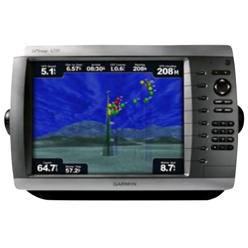
The Garmin GPSMAP 4210 is a mid-sized, feature-rich chartplotter that delivers high-performance navigation and networking capabilities. With a bright 10.4” SVGA display, preloaded BlueChart® g2 maps of the U.S. coast, and the ability to integrate with radar, sonar, and weather systems, this unit is built for serious boaters and anglers.
Key Features
1. 10.4” SVGA Display with Preloaded U.S. Coastal Charts
- Crisp, Video-Quality Resolution: Provides clear, high-detail visuals for maps and video input.
-
Preloaded BlueChart® g2 Marine Cartography: Covers the U.S. coast, Alaska, Hawaii, and the Bahamas, including:
- Detailed coastlines and shaded depth contours
- Navigation aids (navaids), port plans, wrecks, and restricted areas
- Tide and current information for enhanced trip planning
- Worldwide Basemap: High-quality satellite imagery replaces traditional maps for a more intuitive view.
2. Enhanced Navigation with BlueChart® g2 Vision (Optional Upgrade)
Upgrade your GPSMAP 4210 with an optional BlueChart g2 Vision SD™ card to unlock advanced features:
- MarinerEye View & FishEye View: 3D perspectives above and below the waterline.
- High-Resolution Satellite Images & Aerial Photos: Gain better orientation in unfamiliar waters.
- Auto Guidance Technology: Generates safe, obstacle-free routes based on depth, buoys, and other hazards.
3. Garmin Marine Network Connectivity
- Seamless System Expansion: Connect with additional multi-function displays (MFDs) and remote sensors.
- Radar & Sonar Integration: Add high-powered radar and sonar modules for advanced situational awareness.
- XM Satellite Weather & Radio Compatibility: Access real-time weather updates and satellite radio.
4. Multi-Device Sync & Data Sharing
- Network with Other Garmin Chartplotters: Share routes, sonar data, and radar across multiple displays.
- SD™ Card Slot: Expand your navigation with additional chart data and software updates.
Why Choose the Garmin GPSMAP 4210?
The GPSMAP 4210 is the ideal mid-sized marine chartplotter for boaters who need preloaded U.S. coastal maps, a high-resolution display, and seamless connectivity with radar, sonar, and weather systems. Whether you're fishing offshore, cruising coastal waters, or navigating challenging environments, this unit provides reliable and precise navigation.