WhatsApp
 SMS - Text us!
 Email Us!
 Help Desk
- Oregon 600t
- Preloaded U.S. TOPO 100K
- USB/charging cable
- Carabiner clip
- Documentation
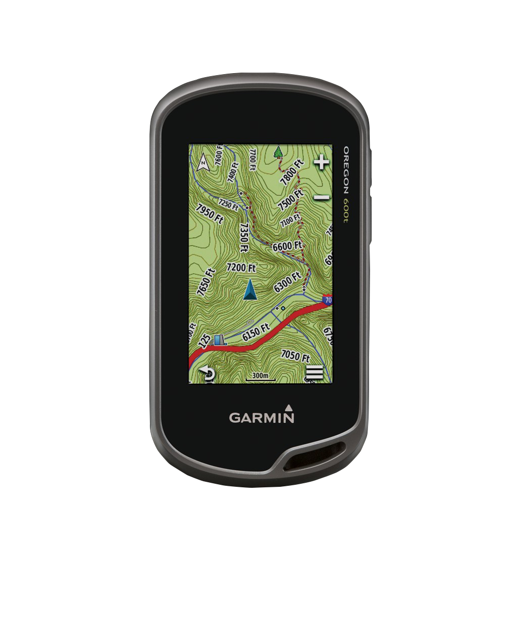
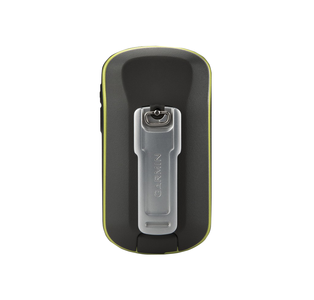
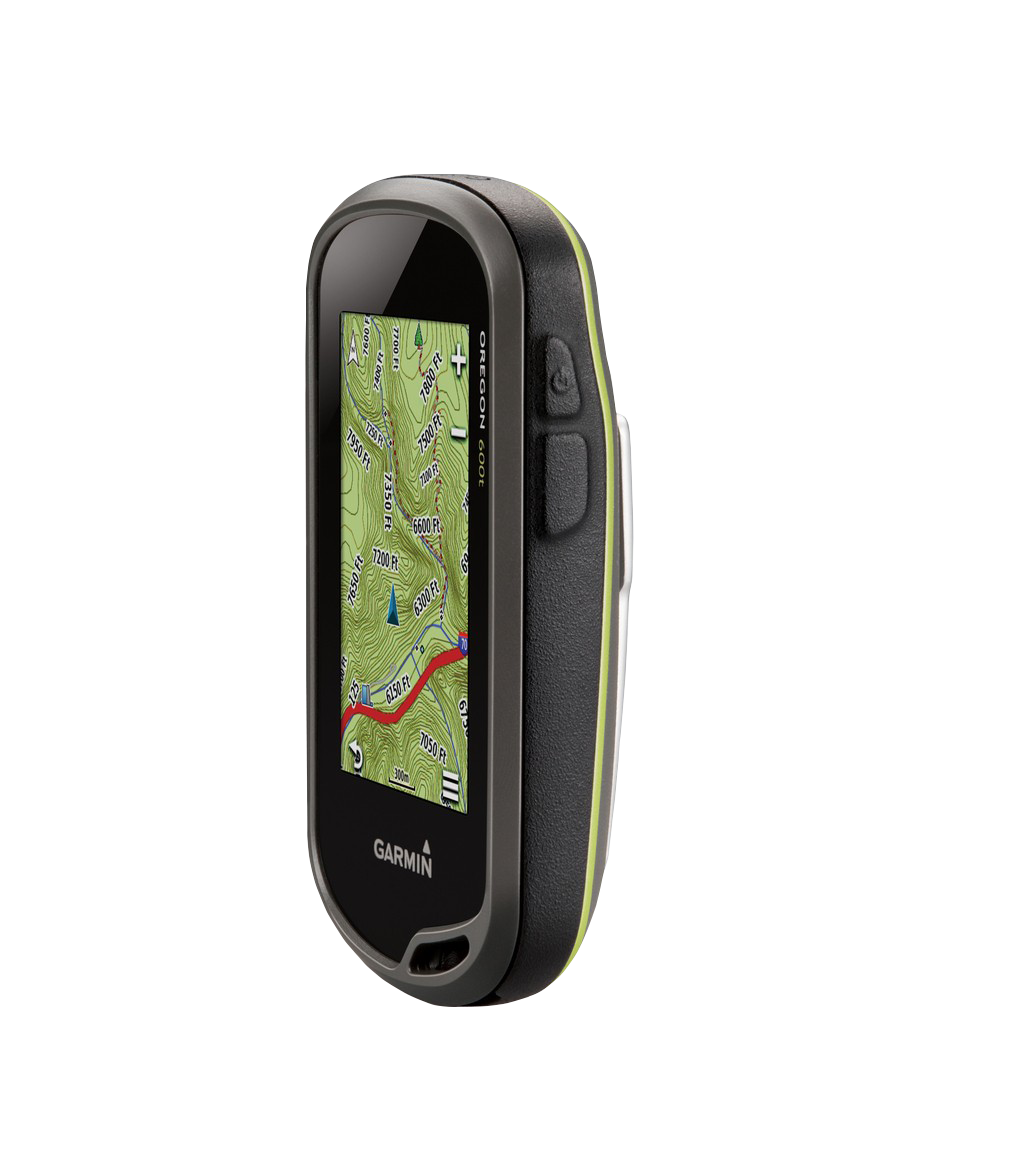
Garmin Oregon 600t, Handheld Touchscreen Outdoor/Trail GPS with TOPO Maps (Garmin Certified Refurbished)
Garmin Oregon 600t, Handheld Touchscreen Outdoor/Trail GPS with TOPO Maps (Garmin Certified Refurbished)
Model Number: 010-N1066-10
Out of stock
Regular price
$237.99
Sale price
$237.99
Regular price
Unit price
per
 View full details
Tech Specs
Garmin Oregon 600t, Handheld Touchscreen Outdoor/Trail GPS with TOPO Maps (Garmin Certified Refurbished)
Unleash your adventurous spirit with the Garmin Oregon 600t, a powerful handheld GPS device designed for outdoor enthusiasts. Featuring cutting-edge technology and user-friendly functionality, this GPS device is perfect for hiking, climbing, and exploring the great outdoors.
Key Features & Benefits:
- High-Sensitivity GPS and GLONASS Tracking: Experience fast and precise location tracking even in challenging environments like heavy cover and deep canyons.
- Preloaded TOPO U.S. Maps: Navigate with confidence using high-quality topographic maps covering the entire U.S., including Alaska, Hawaii, and Puerto Rico.
- Brilliant Touchscreen Display: Enjoy a sunlight-readable, multi-touch reflective display that adjusts for optimum visibility and features a durable, impact-resistant design.
- Dual Battery System: Choose between a rechargeable NiMH pack or traditional AA batteries, with the option to charge while connected to external power.
- Built-In 3-Axis Compass: Stay oriented with an integrated electronic compass that remains accurate even when the device is stationary.
- Barometric Altimeter: Track changes in altitude and monitor weather conditions with precision.
- Wireless Sharing Capability: Share waypoints, tracks, and routes with other Garmin devices quickly and effortlessly.
- Expandable Mapping Options: Easily add TOPO maps, BlueChart® g2 cards, City Navigator® data, and BirdsEye Satellite Imagery for enhanced navigation.
- Advanced Geocaching Features: Hold up to 4 million caches and access paperless geocaching, including descriptions, logs, and photos.
- BaseCamp™ Compatibility: Plan your adventures with BaseCamp software, allowing for detailed map organization and sharing.
- Activity Tracking: Monitor accumulated waypoints, tracks, and geocaches to keep your adventures organized.
- Customizable Dashboard: Personalize your dashboard for quick access to essential functions and data.
Whether you're tackling rugged trails or navigating urban landscapes, the Garmin Oregon 600t is your ultimate companion for outdoor exploration. Elevate your adventures and confidently chart your path with this state-of-the-art GPS device.


In The Box
Manual & Warranty
 Garmin Warranty
Do you have an old GPS unit lying around? The GPS Nation Trade In and Up program is a great way to trade in your old and used GPS for credit towards a new GPS. The choice is entirely yours! We’ve made the process simple and streamlined. Follow these simple steps, and you will be on your way to receiving credit towards your brand new GPS!
1. Get a quote
To get your free quote, provide your GPS type, manufacturer, model, and condition. Within 24 hours, you will receive a quote for the trade-in value of your current product. The GPS trade-in/trade-up form is at the bottom of this page.
2. Ship your product(s) for trade
After accepting our offer, pack your product(s) safely and ship them to us using the pre-paid shipping label provided to you. We will provide a confirmation email when your trade-in arrives at our warehouse. You have 30 days from the date you complete your on-line trade to ship the product to GPS Nation.
3. Make your purchase
Once we receive your product at our warehouse and we validate the stated condition, we will send you a confirmation email. If you elect to receive credit towards a new GPS at gpsnation.com, your store credit will be issued, and you are free to make your purchase.
Reviews
Ask a Question
Tech Specs
Garmin Oregon 600t, Handheld Touchscreen Outdoor/Trail GPS with TOPO Maps (Garmin Certified Refurbished)
Unleash your adventurous spirit with the Garmin Oregon 600t, a powerful handheld GPS device designed for outdoor enthusiasts. Featuring cutting-edge technology and user-friendly functionality, this GPS device is perfect for hiking, climbing, and exploring the great outdoors.
Key Features & Benefits:
- High-Sensitivity GPS and GLONASS Tracking: Experience fast and precise location tracking even in challenging environments like heavy cover and deep canyons.
- Preloaded TOPO U.S. Maps: Navigate with confidence using high-quality topographic maps covering the entire U.S., including Alaska, Hawaii, and Puerto Rico.
- Brilliant Touchscreen Display: Enjoy a sunlight-readable, multi-touch reflective display that adjusts for optimum visibility and features a durable, impact-resistant design.
- Dual Battery System: Choose between a rechargeable NiMH pack or traditional AA batteries, with the option to charge while connected to external power.
- Built-In 3-Axis Compass: Stay oriented with an integrated electronic compass that remains accurate even when the device is stationary.
- Barometric Altimeter: Track changes in altitude and monitor weather conditions with precision.
- Wireless Sharing Capability: Share waypoints, tracks, and routes with other Garmin devices quickly and effortlessly.
- Expandable Mapping Options: Easily add TOPO maps, BlueChart® g2 cards, City Navigator® data, and BirdsEye Satellite Imagery for enhanced navigation.
- Advanced Geocaching Features: Hold up to 4 million caches and access paperless geocaching, including descriptions, logs, and photos.
- BaseCamp™ Compatibility: Plan your adventures with BaseCamp software, allowing for detailed map organization and sharing.
- Activity Tracking: Monitor accumulated waypoints, tracks, and geocaches to keep your adventures organized.
- Customizable Dashboard: Personalize your dashboard for quick access to essential functions and data.
Whether you're tackling rugged trails or navigating urban landscapes, the Garmin Oregon 600t is your ultimate companion for outdoor exploration. Elevate your adventures and confidently chart your path with this state-of-the-art GPS device.
In The Box
- Oregon 600t
- Preloaded U.S. TOPO 100K
- USB/charging cable
- Carabiner clip
- Documentation
Manual & Warranty
Trade-In
Do you have an old GPS unit lying around? The GPS Nation Trade In and Up program is a great way to trade in your old and used GPS for credit towards a new GPS. The choice is entirely yours! We’ve made the process simple and streamlined. Follow these simple steps, and you will be on your way to receiving credit towards your brand new GPS!
1. Get a quote
To get your free quote, provide your GPS type, manufacturer, model, and condition. Within 24 hours, you will receive a quote for the trade-in value of your current product. The GPS trade-in/trade-up form is at the bottom of this page.
2. Ship your product(s) for trade
After accepting our offer, pack your product(s) safely and ship them to us using the pre-paid shipping label provided to you. We will provide a confirmation email when your trade-in arrives at our warehouse. You have 30 days from the date you complete your on-line trade to ship the product to GPS Nation.
3. Make your purchase
Once we receive your product at our warehouse and we validate the stated condition, we will send you a confirmation email. If you elect to receive credit towards a new GPS at gpsnation.com, your store credit will be issued, and you are free to make your purchase.
Overview
Garmin Oregon 600t, Handheld Touchscreen Outdoor/Trail GPS with TOPO Maps (Garmin Certified Refurbished)
Unleash your adventurous spirit with the Garmin Oregon 600t, a powerful handheld GPS device designed for outdoor enthusiasts. Featuring cutting-edge technology and user-friendly functionality, this GPS device is perfect for hiking, climbing, and exploring the great outdoors.
Key Features & Benefits:
- High-Sensitivity GPS and GLONASS Tracking: Experience fast and precise location tracking even in challenging environments like heavy cover and deep canyons.
- Preloaded TOPO U.S. Maps: Navigate with confidence using high-quality topographic maps covering the entire U.S., including Alaska, Hawaii, and Puerto Rico.
- Brilliant Touchscreen Display: Enjoy a sunlight-readable, multi-touch reflective display that adjusts for optimum visibility and features a durable, impact-resistant design.
- Dual Battery System: Choose between a rechargeable NiMH pack or traditional AA batteries, with the option to charge while connected to external power.
- Built-In 3-Axis Compass: Stay oriented with an integrated electronic compass that remains accurate even when the device is stationary.
- Barometric Altimeter: Track changes in altitude and monitor weather conditions with precision.
- Wireless Sharing Capability: Share waypoints, tracks, and routes with other Garmin devices quickly and effortlessly.
- Expandable Mapping Options: Easily add TOPO maps, BlueChart® g2 cards, City Navigator® data, and BirdsEye Satellite Imagery for enhanced navigation.
- Advanced Geocaching Features: Hold up to 4 million caches and access paperless geocaching, including descriptions, logs, and photos.
- BaseCamp™ Compatibility: Plan your adventures with BaseCamp software, allowing for detailed map organization and sharing.
- Activity Tracking: Monitor accumulated waypoints, tracks, and geocaches to keep your adventures organized.
- Customizable Dashboard: Personalize your dashboard for quick access to essential functions and data.
Whether you're tackling rugged trails or navigating urban landscapes, the Garmin Oregon 600t is your ultimate companion for outdoor exploration. Elevate your adventures and confidently chart your path with this state-of-the-art GPS device.