Tech Specs
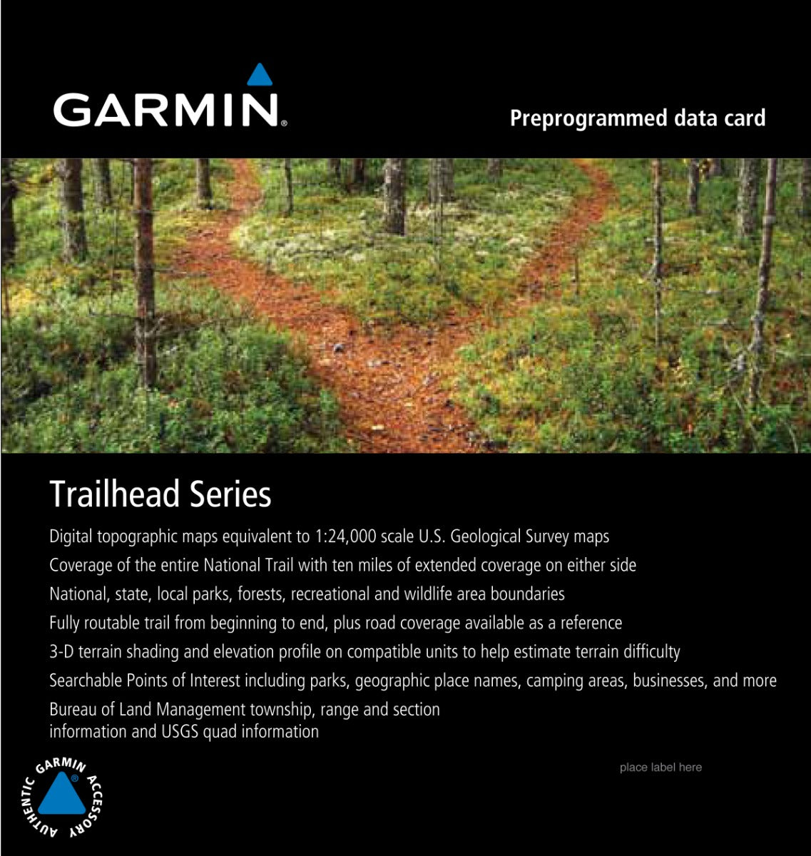
Garmin Trailhead Series - Appalachian Trail, microSD Card
Explore the breathtaking beauty of the Appalachian Trail like never before with the Garmin Trailhead Series microSD Card. This essential accessory is designed for avid hikers and outdoor enthusiasts, offering an array of features that ensure you're well-equipped for your adventure.
Key Features:
- Highly Detailed Digital Topographic Maps: Enjoy maps that are comparable to 1:24,000 scale USGS maps, allowing for precise navigation.
- Fully Routable Trail: Navigate the entire length of the Appalachian Trail with a complete, routable guide from start to finish.
- Comprehensive Coverage: Access basic road coverage as a reference and explore national, state, and local parks, forests, and wildlife areas.
- Hydrographic Features: Discover detailed coastlines, lake and river shorelines, and both perennial and seasonal streams.
- Searchable Points of Interest: Find geographic place names, campgrounds, scenic lookouts, picnic sites, and businesses easily at your fingertips.
- 3-D Terrain Shading: Get a better understanding of terrain difficulty with advanced digital elevation model (DEM) shaded relief on compatible devices.
- Bureau of Land Management Information: Access township, range, and section information, along with USGS quad locations for added navigational support.
- Extended Coverage: Enjoy coverage of the Appalachian Trail plus an additional 10 miles (16 km) on each side for an expansive exploration area.
With the Garmin Trailhead Series microSD Card, you'll have everything you need to confidently embark on your journey along the Appalachian Trail. Don't miss out on the opportunity to enhance your outdoor experience!
In The Box
Manual & Warranty
Do you have an old GPS unit lying around? The GPS Nation Trade In and Up program is a great way to trade in your old and used GPS for credit towards a new GPS. The choice is entirely yours! We’ve made the process simple and streamlined. Follow these simple steps, and you will be on your way to receiving credit towards your brand new GPS!
1. Get a quote
To get your free quote, provide your GPS type, manufacturer, model, and condition. Within 24 hours, you will receive a quote for the trade-in value of your current product. The GPS trade-in/trade-up form is at the bottom of this page.
2. Ship your product(s) for trade
After accepting our offer, pack your product(s) safely and ship them to us using the pre-paid shipping label provided to you. We will provide a confirmation email when your trade-in arrives at our warehouse. You have 30 days from the date you complete your on-line trade to ship the product to GPS Nation.
3. Make your purchase
Once we receive your product at our warehouse and we validate the stated condition, we will send you a confirmation email. If you elect to receive credit towards a new GPS at gpsnation.com, your store credit will be issued, and you are free to make your purchase.
Reviews
Ask a Question
Tech Specs
Garmin Trailhead Series - Appalachian Trail, microSD Card
Explore the breathtaking beauty of the Appalachian Trail like never before with the Garmin Trailhead Series microSD Card. This essential accessory is designed for avid hikers and outdoor enthusiasts, offering an array of features that ensure you're well-equipped for your adventure.
Key Features:
- Highly Detailed Digital Topographic Maps: Enjoy maps that are comparable to 1:24,000 scale USGS maps, allowing for precise navigation.
- Fully Routable Trail: Navigate the entire length of the Appalachian Trail with a complete, routable guide from start to finish.
- Comprehensive Coverage: Access basic road coverage as a reference and explore national, state, and local parks, forests, and wildlife areas.
- Hydrographic Features: Discover detailed coastlines, lake and river shorelines, and both perennial and seasonal streams.
- Searchable Points of Interest: Find geographic place names, campgrounds, scenic lookouts, picnic sites, and businesses easily at your fingertips.
- 3-D Terrain Shading: Get a better understanding of terrain difficulty with advanced digital elevation model (DEM) shaded relief on compatible devices.
- Bureau of Land Management Information: Access township, range, and section information, along with USGS quad locations for added navigational support.
- Extended Coverage: Enjoy coverage of the Appalachian Trail plus an additional 10 miles (16 km) on each side for an expansive exploration area.
With the Garmin Trailhead Series microSD Card, you'll have everything you need to confidently embark on your journey along the Appalachian Trail. Don't miss out on the opportunity to enhance your outdoor experience!
In The Box
Manual & Warranty
Trade-In Program
Do you have an old GPS unit lying around? The GPS Nation Trade In and Up program is a great way to trade in your old and used GPS for credit towards a new GPS. The choice is entirely yours! We’ve made the process simple and streamlined. Follow these simple steps, and you will be on your way to receiving credit towards your brand new GPS!
1. Get a quote
To get your free quote, provide your GPS type, manufacturer, model, and condition. Within 24 hours, you will receive a quote for the trade-in value of your current product. The GPS trade-in/trade-up form is at the bottom of this page.
2. Ship your product(s) for trade
After accepting our offer, pack your product(s) safely and ship them to us using the pre-paid shipping label provided to you. We will provide a confirmation email when your trade-in arrives at our warehouse. You have 30 days from the date you complete your on-line trade to ship the product to GPS Nation.
3. Make your purchase
Once we receive your product at our warehouse and we validate the stated condition, we will send you a confirmation email. If you elect to receive credit towards a new GPS at gpsnation.com, your store credit will be issued, and you are free to make your purchase.
Overview
Garmin Trailhead Series - Appalachian Trail, microSD Card
Explore the breathtaking beauty of the Appalachian Trail like never before with the Garmin Trailhead Series microSD Card. This essential accessory is designed for avid hikers and outdoor enthusiasts, offering an array of features that ensure you're well-equipped for your adventure.
Key Features:
- Highly Detailed Digital Topographic Maps: Enjoy maps that are comparable to 1:24,000 scale USGS maps, allowing for precise navigation.
- Fully Routable Trail: Navigate the entire length of the Appalachian Trail with a complete, routable guide from start to finish.
- Comprehensive Coverage: Access basic road coverage as a reference and explore national, state, and local parks, forests, and wildlife areas.
- Hydrographic Features: Discover detailed coastlines, lake and river shorelines, and both perennial and seasonal streams.
- Searchable Points of Interest: Find geographic place names, campgrounds, scenic lookouts, picnic sites, and businesses easily at your fingertips.
- 3-D Terrain Shading: Get a better understanding of terrain difficulty with advanced digital elevation model (DEM) shaded relief on compatible devices.
- Bureau of Land Management Information: Access township, range, and section information, along with USGS quad locations for added navigational support.
- Extended Coverage: Enjoy coverage of the Appalachian Trail plus an additional 10 miles (16 km) on each side for an expansive exploration area.
With the Garmin Trailhead Series microSD Card, you'll have everything you need to confidently embark on your journey along the Appalachian Trail. Don't miss out on the opportunity to enhance your outdoor experience!


 Garmin Warranty